where do those experiencing ALICE live?
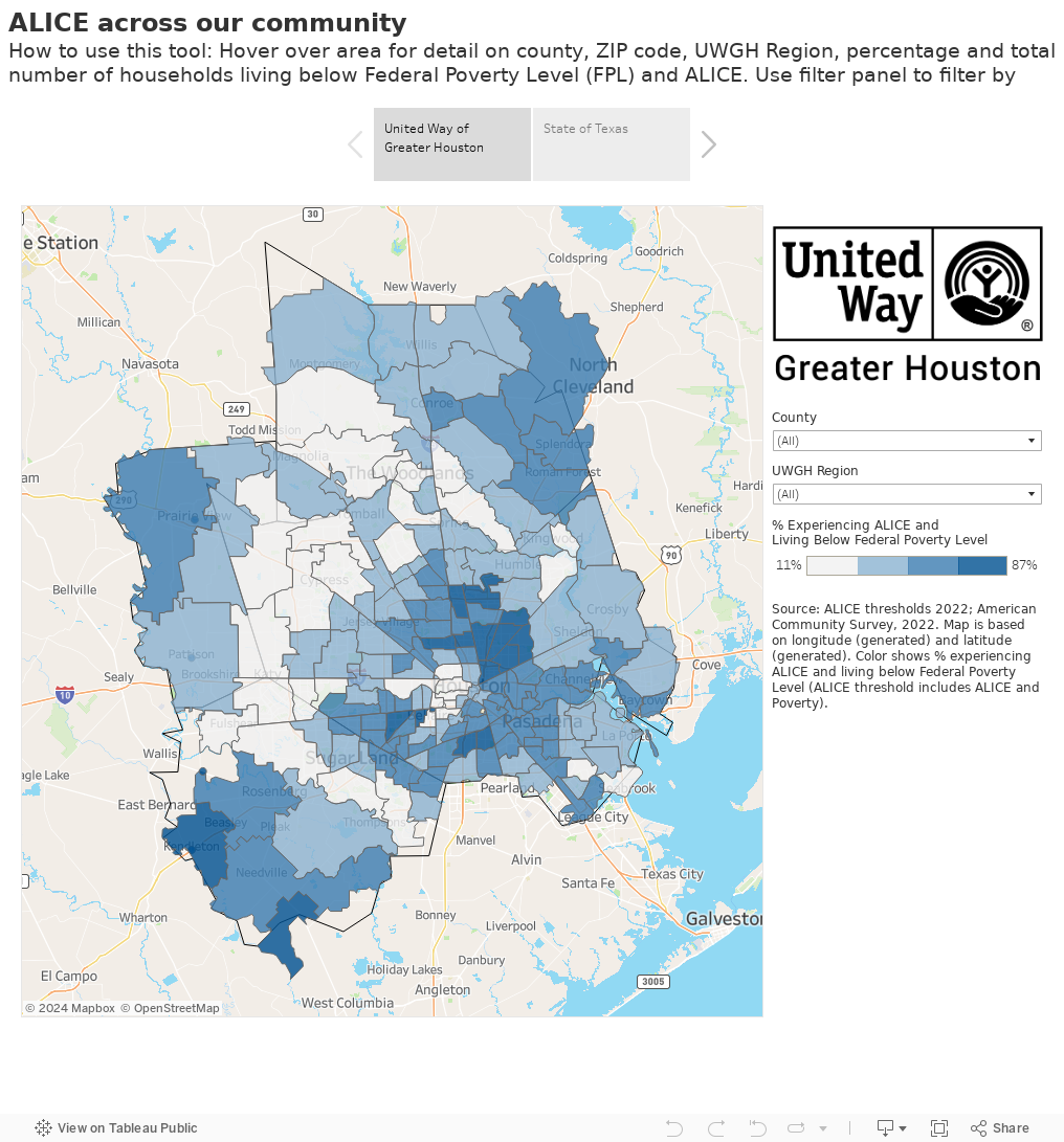
13% of households across Greater Houston are living on wages below the federal poverty threshold, and another 31% of households are working hard but can’t afford the basic necessities of life.
There is significant variation in the number of households that live below the ALICE Threshold within the county and community. This map allows you to explore that data by zip code. The maps are shaded to show the percentage of households living below the ALICE Threshold (poverty-level and ALICE households combined). The darker the blue, the higher the percentage.
For a larger map, or if you have trouble viewing, click here.